Category:1871 maps
Jump to navigation
Jump to search
| ← · 1870 · 1871 · 1872 · 1873 · 1874 · 1875 · 1876 · 1877 · 1878 · 1879 · → |
Deutsch: Karten mit Bezug zum Jahr 1871
English: Maps related to the year 1871
Español: Mapas relativos al año 1871
Français : Cartes concernant l’an 1871
Русский: Карты 1871 года
Subcategories
This category has the following 8 subcategories, out of 8 total.
*
- 1871 maps of the world (6 F)
A
- 1871 maps of Africa (5 F)
E
G
N
S
- 1871 maps of South America (4 F)
Media in category "1871 maps"
The following 141 files are in this category, out of 141 total.
-
"Niagara, Orleans, Genesee, Monroe, and Wayne counties" NYPL1575787.tiff 7,106 × 5,044; 102.55 MB
-
"Onondaga, Cortland, Broome, Madison, and Chenango Counties" NYPL1575789.tiff 5,006 × 6,334; 90.72 MB
-
"St. Lawrence, Franklin, Clinton, and Essex" NYPL1575785.tiff 7,106 × 5,044; 102.55 MB
-
1871 (Meiji 4) Woodblock Map of Japan - Geographicus - Japan-meiji4-1871.jpg 5,000 × 4,322; 3.53 MB
-
GODKIN&WALKER(1871) MAP OF IRELAND.jpg 3,183 × 4,261; 5.53 MB
-
GROBE(1871) Plan der hochfürstl. Residenzstadt HILDBURGHAUSEN.jpg 2,774 × 2,186; 2.46 MB
-
1871 map of Central America showing its political divisions.jpg 3,008 × 2,636; 1.29 MB
-
669848 1871 Почтовая карта вырезка.jpg 461 × 472; 60 KB
-
Ancient Palestine (FL35081084 3890405).jpg 8,601 × 10,495; 126.63 MB
-
Appendix NYPL1575810.tiff 5,092 × 6,404; 93.3 MB
-
Armenia by William Hughes, 1871.jpg 2,048 × 1,653; 855 KB
-
Asher & Adams' New York and part of Ontario. LOC 2003627101.jpg 7,056 × 5,183; 9.57 MB
-
Asher & Adams' New York and part of Ontario. LOC 2003627101.tif 7,056 × 5,183; 104.63 MB
-
Bidrag til kundskab om Egefamilien i nutid og fortid BHL15088421.jpg 2,526 × 1,929; 364 KB
-
Bird's eye view of Peshtigo, Wisconsin Sept. 1871. LOC 93681235.jpg 5,208 × 4,248; 5.17 MB
-
Bird's eye view of Peshtigo, Wisconsin Sept. 1871. LOC 93681235.tif 5,208 × 4,248; 63.3 MB
-
Bird's eye view of the city of Knoxville, Knox County, Tennessee 1871. LOC 73694529.jpg 8,688 × 6,944; 12.65 MB
-
Bird's eye view of the city of Little Rock, the capitol of Arkansas 1871. LOC 73693338.jpg 10,496 × 7,072; 16.99 MB
-
Birds eye view of the city of Atlanta, the capitol of Georgia 1871. LOC 73693339.jpg 8,928 × 7,024; 14.12 MB
-
Birds eye view of the city of Baxter Springs, Kansas, 1871 LOC 2001620090.jpg 6,275 × 5,458; 4.19 MB
-
Birds eye view of the city of Baxter Springs, Kansas, 1871 LOC 2001620090.tif 6,275 × 5,458; 97.99 MB
-
Birds eye view of the city of Chattanooga, Hamilton County, Tennessee 1871. LOC 73694525.jpg 9,360 × 6,877; 16.24 MB
-
Colton's Brazil with Guayana. LOC 2003627063.jpg 4,161 × 5,134; 3.95 MB
-
Colton's Brazil with Guayana. LOC 2003627063.tif 4,161 × 5,134; 61.12 MB
-
Crawfordsville, Ind. (2673832283).jpg 2,000 × 1,513; 3.18 MB
-
Donau - Burg Wörth.JPG 1,583 × 886; 259 KB
-
Edward Henry Palmer, Route map of the Negeb or south country (FL6882036 2369576).jpg 2,523 × 2,450; 1.94 MB
-
Elizabeth Rundle Charles, Jerusalem and its environs (FL35058346 2369834).jpg 5,296 × 5,428; 34.24 MB
-
Erie County NYPL1575771.tiff 5,116 × 6,482; 94.88 MB
-
Europe NYPL1575779.tiff 7,148 × 5,124; 104.79 MB
-
Geneva, Wis. (2675953224).jpg 2,000 × 1,392; 2.56 MB
-
Herkimer, Hamilton, and Montgomery NYPL1575784.tiff 4,880 × 6,444; 89.97 MB
-
HorseCreekValley-SC Boles 1871.png 363 × 439; 373 KB
-
Index NYPL1575773.tiff 5,022 × 6,318; 90.78 MB
-
Jefferson, Oswego, and Lewis Counties NYPL1575783.tiff 7,106 × 5,044; 102.55 MB
-
Karte Archidiaconate und Decanate des Bischtums Constanz.jpg 4,212 × 4,377; 5.69 MB
-
Kazanskaya gubernia 1871.jpg 2,837 × 2,264; 1.54 MB
-
Map of Atlantic & Pacific Rail Road, 1871. LOC 96680709.jpg 4,786 × 3,779; 2.51 MB
-
Map of Atlantic & Pacific Rail Road, 1871. LOC 96680709.tif 4,786 × 3,779; 51.75 MB
-
Map of Atlantic and Pacific Rail Road (10174995993).jpg 800 × 661; 124 KB
-
Map of Bucharest 1871-Maior D. Pappasoglu.jpg 7,040 × 4,843; 3.85 MB
-
Map of Lewistown Illinois 1871.jpg 627 × 623; 320 KB
-
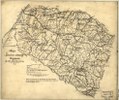
Map of Louisa County, Virginia LOC 2003683405.jpg 4,308 × 3,618; 2.57 MB
-
Map of Louisa County, Virginia LOC 2003683405.tif 4,308 × 3,618; 44.59 MB
-
Map of McKean Co., Pennsylvania - from actual surveys and official records LOC 2012592202.jpg 15,055 × 16,437; 27.03 MB
-
Map of McKean Co., Pennsylvania - from actual surveys and official records LOC 2012592202.tif 15,055 × 16,437; 707.99 MB
-
Map of Palestine in the time of our Saviour (FL35103497 3892782).jpg 6,775 × 8,389; 75.15 MB
-
Map of Saline County, Missouri LOC 2012593052.jpg 10,767 × 13,179; 22.34 MB
-
Map of Saline County, Missouri LOC 2012593052.tif 10,767 × 13,179; 405.97 MB
-
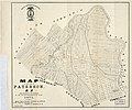
Map of the city of Paterson, N.J. LOC 2011593649.jpg 7,301 × 6,070; 5.18 MB
-
Map of the city of Paterson, N.J. LOC 2011593649.tif 7,301 × 6,070; 126.79 MB
-
Map of the Marietta and Pittsburgh Railroad and its connections. LOC 98688707.jpg 7,194 × 4,528; 6.93 MB
-
Map of the Marietta and Pittsburgh Railroad and its connections. LOC 98688707.tif 7,194 × 4,528; 93.2 MB
-
Map of the Oregon Territory. LOC 98687152.jpg 10,459 × 7,055; 12.05 MB
-
Map of the Oregon Territory. LOC 98687152.tif 10,459 × 7,055; 211.11 MB
-
Map of the Philadelphia and Erie Railway, branches and connecting lines. LOC 98688771.jpg 6,790 × 4,763; 5.26 MB
-
Map of the Philadelphia and Erie Railway, branches and connecting lines. LOC 98688771.tif 6,790 × 4,763; 92.53 MB
-
Map of the rail roads of Pennsylvania and parts of adjoining states. LOC 98688553.jpg 13,137 × 9,219; 17.99 MB
-
Map of the rail roads of Pennsylvania and parts of adjoining states. LOC 98688553.tif 13,137 × 9,219; 346.5 MB
-
Map of The River Jordan. 1871.jpg 1,679 × 2,734; 1.09 MB
-
Map of Virginia LOC 2007627314.jpg 10,750 × 5,339; 8.55 MB
-
Map of Virginia LOC 2007627314.tif 10,750 × 5,339; 164.21 MB
-
Map of Washington County, Mississippi LOC 2012593697.jpg 16,554 × 12,808; 27.98 MB
-
Map of White County, Illinois LOC 2013593095.jpg 12,305 × 15,196; 30.55 MB
-
Map of Woodsburgh, Long Island. LOC 77693693.jpg 9,119 × 11,810; 12.58 MB
-
Map showing the Grand Rapids & Indiana Railroad, and its connections. LOC 98688669.jpg 2,568 × 3,216; 2.02 MB
-
Map showing the Grand Rapids & Indiana Railroad, and its connections. LOC 98688669.tif 2,568 × 3,216; 23.63 MB
-
Map showing the line of the Cairo & Fulton Railroad and its connections. LOC 98688610.jpg 6,800 × 7,354; 11.75 MB
-
Map showing the line of the Cairo & Fulton Railroad and its connections. LOC 98688610.tif 6,800 × 7,354; 143.07 MB
-
Map showing the line of the Plymouth, Kankakee, & Pacific Railroad and its connections. LOC 98688781.tif 19,012 × 4,479; 243.63 MB
-
Massachusetts Central Railroad 1871 Map.jpg 5,967 × 4,028; 3.96 MB
-
NAJDA-E002033 Chart of the world on Mercator's projection.jpg 9,256 × 5,875; 15.18 MB
-
Oberamt Backnang Karte.jpg 6,937 × 7,524; 8.58 MB
-
Paris und Umgebung 1871, Saint-Denis cropped brightness.png 619 × 601; 706 KB
-
Parts of Idaho, Montana and Wyoming territories (8347615560).jpg 800 × 707; 125 KB
-
Parts of Idaho, Montana and Wyoming territories (9138377678).jpg 800 × 710; 131 KB
-
Plano topografico de Santiago.jpg 3,180 × 2,172; 4.75 MB
-
Planul Pappasoglu detaliu.jpg 1,600 × 543; 312 KB
-
Pompéi. - Plan de la maison de Pansa. (19360316739).jpg 2,477 × 4,042; 1.6 MB
-
Preliminary map of Hanover County, Virginia LOC 2003683402.jpg 4,982 × 4,141; 2.9 MB
-
Preliminary map of Hanover County, Virginia LOC 2003683402.tif 4,982 × 4,141; 59.02 MB
-
Preliminary map of Lunenburg County, Virginia LOC 2005625181.jpg 7,994 × 7,511; 7.46 MB
-
Preliminary map of Lunenburg County, Virginia LOC 2005625181.tif 7,994 × 7,511; 171.78 MB
-
Preliminary map of Lunenburg County, Virginia LOC 2012592147.jpg 6,969 × 6,212; 5.31 MB
-
Preliminary map of Lunenburg County, Virginia LOC 2012592147.tif 6,969 × 6,212; 123.86 MB
-
Preliminary map of Orange County, Virginia LOC 2005625186.jpg 4,608 × 2,952; 2.01 MB
-
Preliminary map of Orange County, Virginia LOC 2005625186.tif 4,608 × 2,952; 38.92 MB
-
Preliminary map of Prince Edward County, Virginia LOC 2005625187.jpg 4,511 × 3,887; 2.22 MB
-
Preliminary map of Prince Edward County, Virginia LOC 2005625187.tif 4,511 × 3,887; 50.17 MB
-
Preliminary map of Surry County, Virginia LOC 2005625190.jpg 4,648 × 3,551; 2.23 MB
-
Preliminary map of Surry County, Virginia LOC 2005625190.tif 4,648 × 3,551; 47.22 MB
-
Railroad and post office map of Minnesota and Wisconsin. LOC 98688399.jpg 8,195 × 10,969; 14.36 MB
-
Railroad and post office map of Minnesota and Wisconsin. LOC 98688399.tif 8,195 × 10,969; 257.18 MB
-
Railroads of the state. NYPL1575774.tiff 7,038 × 5,124; 103.18 MB
-
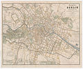
Sineck Grundriss von Berlin 1871.jpg 10,554 × 8,797; 37.67 MB
-
Spitsbergen partial map by August Petermann 1871.jpg 2,116 × 2,548; 1.12 MB
-
Stephen Hawes, The Path of Jesus as he went about doing good (FL45582964 3925904).jpg 2,668 × 1,955; 2.17 MB
-
Taunton (3720671690).jpg 1,024 × 639; 575 KB
-
Transactions (1871) (14590304577).jpg 1,610 × 2,486; 617 KB
-
View of Washington City. LOC 90683459.jpg 7,340 × 5,340; 6.44 MB
-
William Henry Bartlett, Panorama of Jerusalem (FL35058349 2369835).jpg 11,839 × 4,250; 58.8 MB
-
Yellowstone National Park - LOC 97683567.jpg 3,696 × 4,312; 3.41 MB
-
Yellowstone National Park - LOC 97683567.tif 3,696 × 4,312; 45.6 MB
-
Деревня Котово на карте 1871 года.png 591 × 449; 506 KB
-
Сиротинская на карте Земли Войска донского, 1871 год.jpeg 2,867 × 2,910; 3.85 MB


_Woodblock_Map_of_Japan_-_Geographicus_-_Japan-meiji4-1871.jpg/120px-1871_(Meiji_4)_Woodblock_Map_of_Japan_-_Geographicus_-_Japan-meiji4-1871.jpg)
_MAP_OF_IRELAND.jpg/90px-GODKIN%26WALKER(1871)_MAP_OF_IRELAND.jpg)
_Plan_der_hochfürstl._Residenzstadt_HILDBURGHAUSEN.jpg/120px-GROBE(1871)_Plan_der_hochfürstl._Residenzstadt_HILDBURGHAUSEN.jpg)


.jpg/98px-Ancient_Palestine_(FL35081084_3890405).jpg)


_NYPL1575772.tiff/lossy-page1-98px-Asher_%26_Adams%27_New_Topographical_Atlas_and_Gazetteer_of_New_York._(Title_page)_NYPL1575772.tiff.jpg)


.jpg/80px-Boston_Clinton_Fitchburg_and_Mansfield_Framingham_Lowell_Railroads%2C_and_connections_(8249586125).jpg)


.jpg/120px-Crawfordsville%2C_Ind._(2673832283).jpg)

.jpg/120px-Edward_Henry_Palmer%2C_Route_map_of_the_Negeb_or_south_country_(FL6882036_2369576).jpg)
.jpg/117px-Elizabeth_Rundle_Charles%2C_Jerusalem_and_its_environs_(FL35058346_2369834).jpg)


.jpg/120px-Geneva%2C_Wis._(2675953224).jpg)


.jpg/120px-Ibach_Landesarchiv_Baden-Wuerttemberg_Staatsarchiv_Freiburg_K_12-2_Nr._247_Bild_1_(5-873504-2).jpg)
._LOC_88690556.jpg/109px-Index_map_for_sheets%2C_extract_of_military_map_of_N.E._Virginia_showing_forts_and_roads_-_(Washington_D.C._metropolitan_area)._LOC_88690556.jpg)
._LOC_88690556.tif/lossy-page1-109px-Index_map_for_sheets%2C_extract_of_military_map_of_N.E._Virginia_showing_forts_and_roads_-_(Washington_D.C._metropolitan_area)._LOC_88690556.tif.jpg)


.jpg/120px-Map_of_Atlantic_and_Pacific_Rail_Road_(10174995993).jpg)


.jpg/97px-Map_of_Palestine_in_the_time_of_our_Saviour_(FL35103497_3892782).jpg)


.jpg/120px-Parts_of_Idaho%2C_Montana_and_Wyoming_territories_(8347615560).jpg)
.jpg/120px-Parts_of_Idaho%2C_Montana_and_Wyoming_territories_(9138377678).jpg)


.jpg/73px-Pompéi._-_Plan_de_la_maison_de_Pansa._(19360316739).jpg)


.jpg/120px-Revised_plan_of_house_lots_belonging_to_the_Duxbury_Shore_Co.%2C_Duxbury%2C_Mass.%2C_July_1871_(9475356896).jpg)


.jpg/120px-Stephen_Hawes%2C_The_Path_of_Jesus_as_he_went_about_doing_good_(FL45582964_3925904).jpg)
.jpg/120px-Taunton_(3720671690).jpg)
.jpg/120px-The_Holy_Land_exhibiting_the_places_%26_cities_mentioned_in_the_Old_%26_New_Testament_(FL37110434_3893142).jpg)
_LOC_87693316.jpg/93px-Topographical_sketch_of_the_environs_of_Washington%2C_D.C._-_(survey_of_locality_for_public_park_%26_site_for_a_presidential_mansion)_LOC_87693316.jpg)
_LOC_87693316.tif/lossy-page1-93px-Topographical_sketch_of_the_environs_of_Washington%2C_D.C._-_(survey_of_locality_for_public_park_%26_site_for_a_presidential_mansion)_LOC_87693316.tif.jpg)
_(14590304577).jpg/78px-Transactions_(1871)_(14590304577).jpg)


